A quick look at how the Avian Knowledge Network helps KBO help birds
It’s easy to think of the process of data collection ending once a technician sets down their pencil and returns from the field. But when the goal is to use data to inform bird conservation decisions for years to come, this is only the beginning of the data’s journey.
KBO has been involved in the Avian Knowledge Network (AKN), a partnership of federal and state agencies and non-governmental organizations, since its inception. Currently, the AKN consists of a secure, cloud computing system hosted by Point Blue Conservation Science. The components of this system–including a database and tools for data entry, management, analysis, and decision support—were built specifically for data from structured bird surveys (observations of birds collected with a standardized amount of effort at randomly selected locations), and allow users to efficiently enter, clean, manage, analyze, and share their data. Join us as we take a quick look at how KBO uses the AKN to organize, apply, and archive the data we collect during our Point Count surveys each year.
Pre-Season

It all starts with an “AKN Protocol.” Like many organizations, KBO uses a point count methodology to survey for birds. An AKN Protocol lays out a specific format that the database expects the data from these surveys to arrive in and keeps track of the meaning of various codes used in the data. This is important because it allows a future biologist to understand how our data were collected when analyzing bird abundance or trends. The protocol for these surveys is also posted on the AKN so other biologists can find and use our specific methodology in their projects.
Another major advantage of the AKN is that it stores the survey locations where point counts take place. Before the field season, KBO’s Point Count Program Lead, Tom McLaren, can quickly download these coordinates from the system and upload them onto GPS units for our technicians to navigate with in the field. The AKN also stores all data records with their geographic coordinate information attached, so future biologists will always know exactly where surveys occurred.
As our seasonal point count technicians arrive in late April, they each register for an AKN account, giving them the ability to enter data later and the database links their name to all the observations they will make in the field.
During the Point Count Season

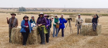
After a rigorous two weeks of training on our point count methodology, field safety, and local bird identification, technicians head out into the field for several months of data collection. This is no small feat, as they navigate to their assigned sampling locations throughout the Pacific Northwest, set out before dawn each day, and observe, identify, and record all birds seen or heard during surveys. Data is meticulously collected on paper datasheets with pencils and clipboards, allowing for fast notetaking and minimal disturbance to birds nearby.
Throughout the season, technicians carefully review each datasheet and correct any errors made in the field. (It’s easy to accidentally skip a line or record a time wrong when there’s an elusive Yellow-breasted Chat making a sudden appearance on a bare limb, or you can’t quite tell if the song you just heard was a Black-throated Gray Warbler or a Hermit Warbler!) Once each page has been carefully reviewed, technicians begin entering all of the information they collected in the AKN’s data entry page. This webpage is set up to receive data in the same way it was recorded in the field. It includes built-in checks to prevent typos and ensure that all necessary information has been entered for each survey. Technicians look over the data on the screen one final time before giving it the OK to be reviewed by the Project Leader (get ready, Tom! The data are headed your way).
Post-Season
After the season has ended and all data has been entered, Tom checks that data are present in the AKN for every survey that occurred. Any missing information is tracked down,

and unusual records are investigated—both of which are tedious but important processes until finally the data are ready.
With the push of a button, the clean data are downloaded in a format that is easily summarized and combined with the vegetation data technicians collected in the same locations they searched for birds. A summary of the effort for the season is compiled, analyses are run, and results about the abundance and distribution of breeding birds are provided to the partners stewarding the land where surveys occurred.
Last, Tom ensures that a “sharing level” is set for each survey event. This designates the amount of information from our surveys that is available to other AKN users, with a span of options from keeping the surveys totally restricted to sharing all data openly.
Beyond the KBO Point Count Season
It’s not just KBO that benefits from using the AKN; this powerful tool solves a myriad of problems surrounding the management of bird data, opening the door for informed conservation action at broad scales.
Earlier methods for data entry and management involved typing data into personalized databases that looked very different across organizations. In the AKN, all datasets have the same set of required information – such as the date, time, and location of surveys – and follow rules for how this information can be entered – such as consistent date and time formats. This saves massive amounts of time when pulling together datasets from many different sources, increasing the amount of information available to answer important conservation questions. Users can also download a “smoothed” version of the data, which combines data from multiple protocols into one clean table that can be quickly and efficiently used for an analysis.
Data entered into the AKN is housed for the long run, meaning the database will continue to be accessible and maintained for the foreseeable future. This allows for the buildup of long-term datasets, which are crucial for assessing human impact in the decades to come. Plus, KBO’s data contributes to publicly available AKN tools such as the observation map, phenology tool, and Rapid Avian Information Locator (RAIL) tool. These show where species have been detected on surveys previously, summarize the time of year species have been observed within a selected area, and provide a list of the species that are expected to occur within or near a selected location based on multiple data sources.
By continuing to use the AKN and expand the partnerships involved, KBO is helping support the compilation of structured bird survey data across broad scales, increasing the reach and effectiveness of our (and all our partners’) bird conservation efforts.